
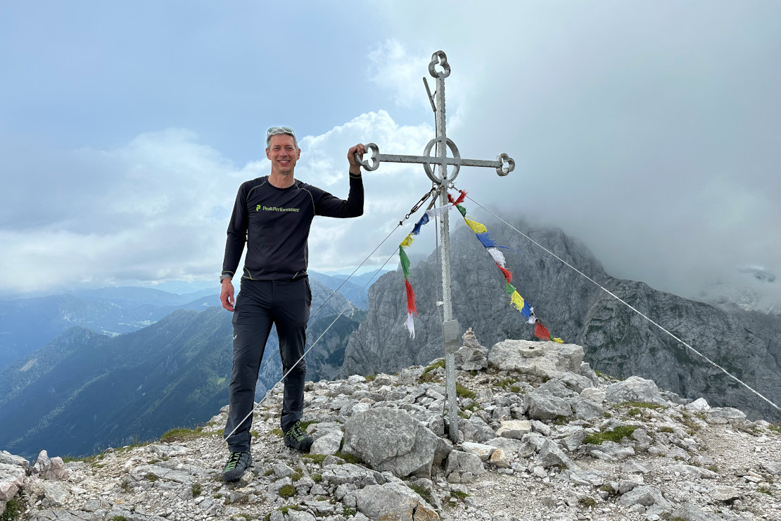
Mount Brana is a ridge mountain located in the Kamnik–Savinja Alps. It lies along the main ridge, which includes some of the highest and most well-known peaks in the area: Kočna (2,540 m), Grintovec (2,558 m), Skuta, Turska Gora (2,251 m), Brana (2,253 m), Planjava (2,394 m), and Ojstrica (2,350 m). Brana is probably the easiest peak to climb along this ridge, making it an ideal choice for those looking for a challenge without tackling a highly technical ascent.
The Kamnik–Savinja Alps are lower than the Julian Alps, which might make them seem easier to climb at first. However, the valleys are also lower, meaning the total elevation gain is often quite similar. From Kamniška Bistrica (601 m) to the summit of Brana (2,253 m), the elevation gain is 1,652 meters. For comparison, in our previous blog post about Stenar, the elevation gain was 1,521 meters, as the Vrata Valley starts at a higher altitude of 980 meters.
Brana is located between the Kamniška Bistrica Valley and the Logar Valley. In the summer of 2024, I climbed Brana from the Kamniška Bistrica side, as it is closer to Ljubljana. My original plan was to climb Planjava on the opposite side of the Kamnik saddle, but due to the weather and other circumstances, I had to change my plans.
How to Get to Kamniška Bistrica
Kamniška Bistrica is located about 35 kilometers almost directly north of Ljubljana, and it takes around 45 minutes to get there by car. The road passes through the town of Komenda, the hometown of Tadej Pogačar, and then continues through Kamnik. If you’re lucky, you might even spot him out on a training ride. There is a good parking area just before the Kamniška Bistrica Hut.
It’s always a good idea to carry some cash, as not all parking lots accept cards. It may also not be possible to pay by card at the huts along the trail.
If you’re reading this post in our app, you can select Show on map in the top-right menu to view directions from your current location.
Hiking to the top of Brana
There are trails to the summit of Brana from both the Kamniška Bistrica Valley and the Logar Valley. This post describes the route from Kamniška Bistrica. The hike to the top is not technically difficult, but it is long. There are no via ferrata sections along the way; however, you can expect some steeper and slightly exposed terrain near the summit.
The Path to the Summit
The trail to the summit of Brana consists of two sections. The first section climbs up to the Kamnik Saddle, where there is a hut. This part takes about 3 hours and 45 minutes, with an elevation gain of approximately 1,244 meters, from 601 m to 1,845 m. From the hut, it then takes around 1 hour and 5 minutes to reach the summit.
If you are reading this post in our app, you can select Hiking directions in the app’s menu at the top right to view a map with the route highlighted.
Part 1 - Kamniška Bistrica - Kamnik Saddle (3,45 hours)
From the parking lot at the Kamniška Bistrica Hut, we follow the same road we arrived on. The road gently slopes upward and passes the hut. After a few hundred meters, we turn right onto a path that climbs steeply into the forest.
Within 10–20 minutes, we pass the valley station of the transport cable car that goes up to the hut on the Kamnik Saddle. The cable car will be visible alongside the trail for most of the ascent.
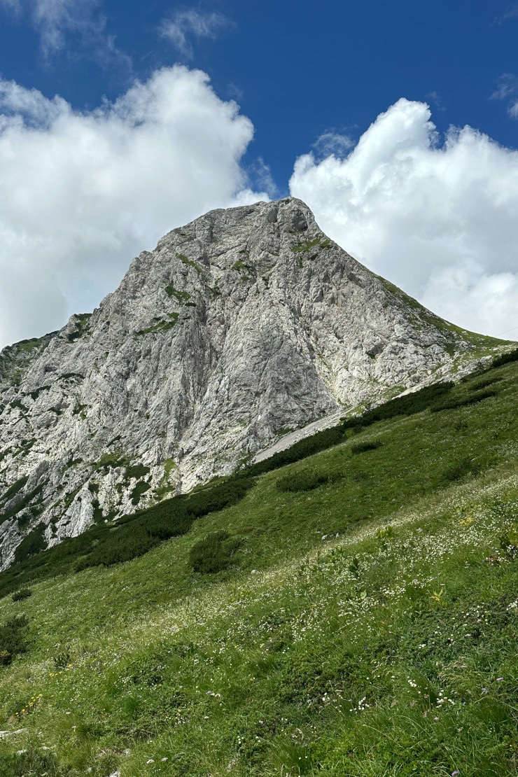
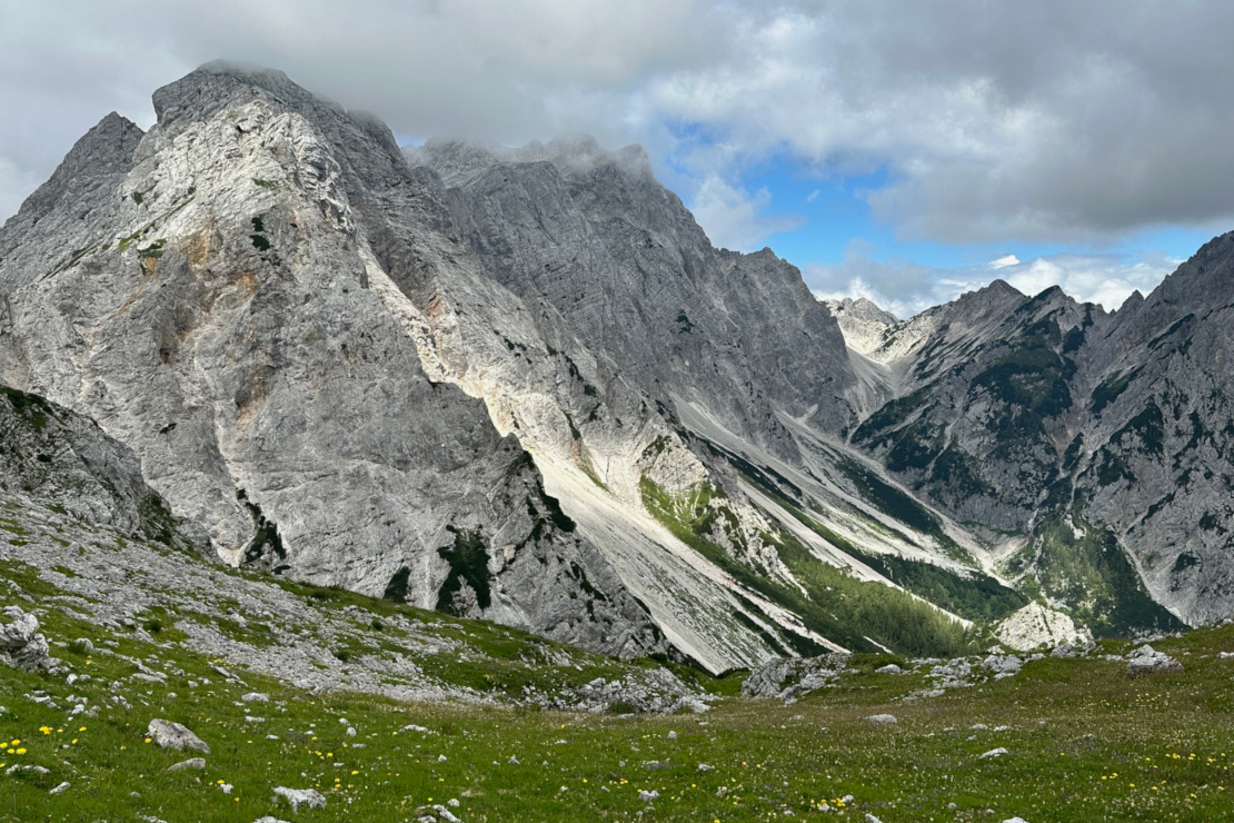
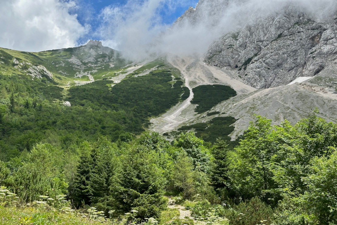
About two-thirds of the way, the trail passes through a forest that gradually thins as we gain elevation. When roughly one-third of the climb remains, we emerge onto a steep meadow, passing a shepherd’s cabin along the way. The rest of the route continues through open terrain, dotted with some rhododendron bushes. The meadow stretches all the way up to the Kamnik Saddle, where the hut is located. Along the way, we are treated to beautiful views of the mountains Brana on the left and Planjava on the right.
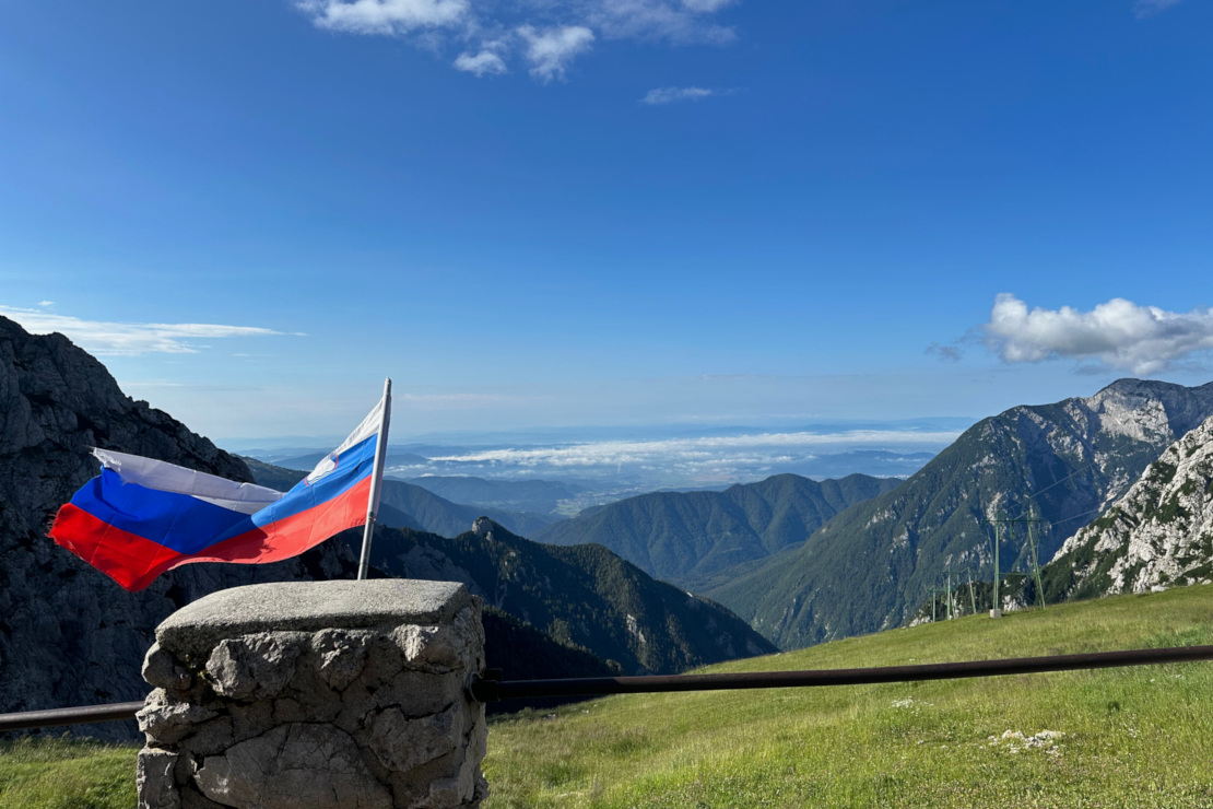
When we reach the top of the saddle, we are rewarded with fantastic views to the north over the Logar Valley and, further beyond, Austria. To the south, the view stretches down toward the Ljubljana Valley.
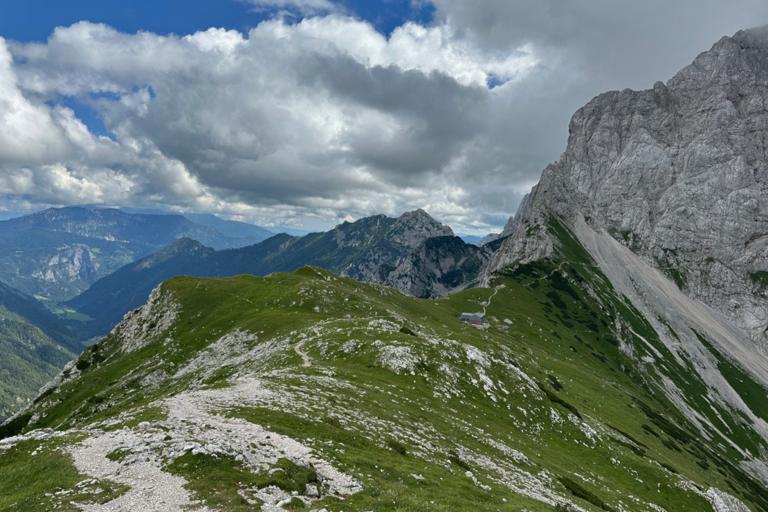
Part 2 - Kamnik Saddle - Brana (1,05 hours)
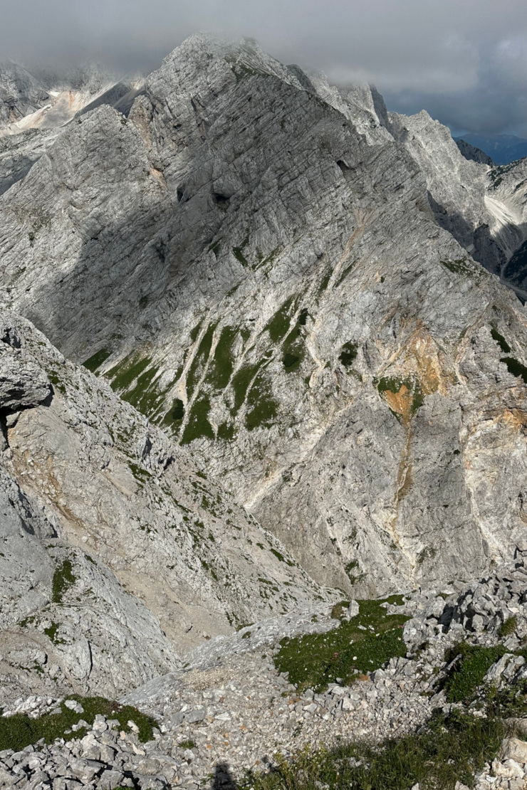
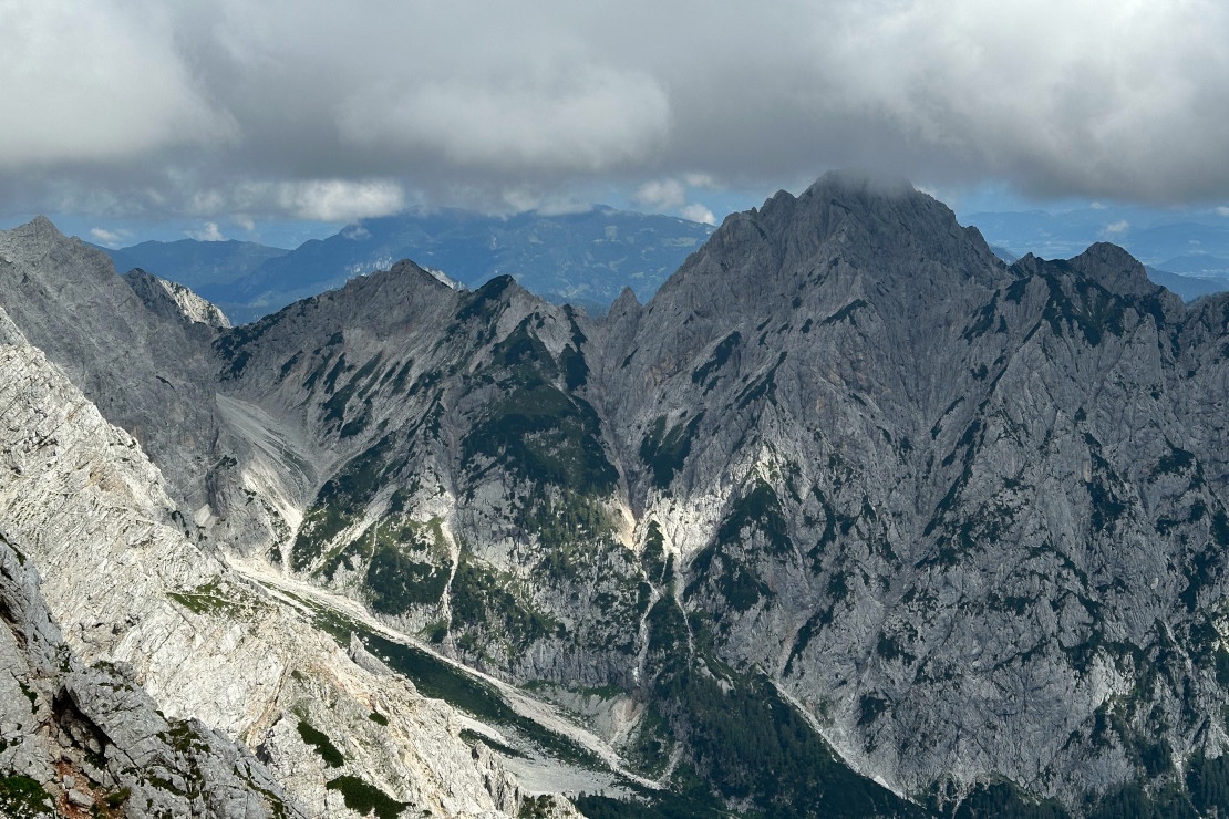
From the Kamnik Saddle, we continue toward Brana by first crossing its northern mountainside. From this vantage point, we are treated to fantastic views of the Logar Valley and the main ridge of the Kamnik–Savinja Alps, with Turska Mountain as the closest neighbor.
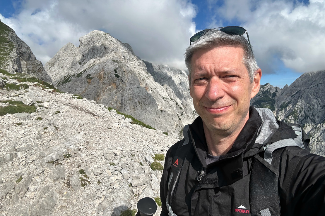
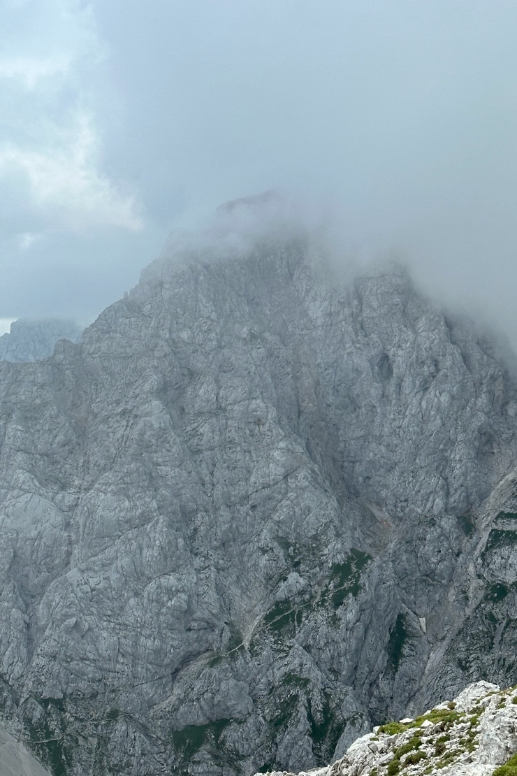
After crossing the mountainside, the trail turns upward and becomes somewhat more exposed. From here, we follow the ridge all the way to the summit. Climbing up along the ridge is manageable, but on the descent, the view straight down into the valley can be dizzying for those not accustomed to heights.
Panorama video from the mountainside and summit of Brana, with views of Turska Mountain, Logar Valley, Kamnik Saddle, and Mount Planjava.
Huts on the Way
The first hut, the Kamniška Bistrica Hut, is located right at the start of the hike. It serves both food and drinks, with a menu focused primarily on traditional Slovenian alpine cuisine.
The second hut, located on the Kamnik Saddle about an hour from the summit of Brana, also serves traditional Slovenian alpine cuisine. Overnight stays are possible. More information about the hut can be found here, and accommodation can be booked directly on the website.
What to think about when hiking
We’ve already covered important considerations for hiking in the Alps in previous blog posts. Read the sections “Hiking in the Julian Alps” in the Julian Alps post and part of the section “How to Hike up to Mount Stol” in the Mount Stol post.
Equipment
When hiking in the Kamnik-Savinja alps, equipment is important. You need to be able to handle a full day in the mountains and in an environment where the weather can change quickly.
- A good pair of hiking boots.
- Hiking poles (recommended, especially for the steep sections and descent).
- Appropriate clothing for the weather. If rain is possible, bring waterproof gear. Remember that the sun can be strong at high altitudes, so sun protection is also important.
- A backpack with provisions, including plenty of water and food for the climb. Nutrition bars or energy snacks are useful for quick refueling.
Where to Stay
There are many places to stay around Kamniška Bistrica, ranging from hotels and apartments to villas.
- Guest house Pr Ambruzarju & Apartments - Apartments offering beautiful views of the Ljubljana Valley and the Kamnik–Savinja Alps.
- Kamnik Saddle hut - The hut on the Kamnik Saddle offers overnight stays. During the summer high season, the Kamnik–Savinja Alps attract many hikers, so it’s advisable to book a room well in advance.
- Villas and apartments - There are many apartments and villas available for rent in the vicinity of Kamniška Bistrica.
Where to Eat
Below are some places to eat in the vicinity of Kamniška Bistrica.
- Kamnik Saddle hut - The hut serves traditional Slovenian alpine cuisine, making it a perfect place to stop for a meal on the way up or down from one of the neighboring summits.
- Kamniška Bistrica hut - This hut also serves traditional Slovenian alpine cuisine. In addition to mountaineers, there are usually quite a few tourists here as well.
- Slovenia Eko Resort - A restaurant in nature with beautiful surroundings, located just below Velika Planina.

